During the city of Washington, D.C.’s crowdsourced Apps for Democracy 2 project, one of the top requested apps was a GPS notification system for public transportation.
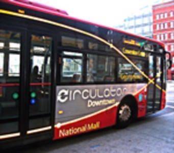
For those of you who’ve not had the pleasure of residing in our nation’s capital and the outlying cities and suburbs of Virginia and Maryland, public transpo is a large part of commuter culture. So, based on the Apps for Democracy feedback, the D.C. Department of Transportation got together with the Office of Planning and the office of the city’s CTO to develop Where’s My Bus? It’s a mobile application (that works on the web, as well) for getting users real-time GPS information on buses along the five-route D.C. Circulator system.
By way of background information, Apps for Democracy is a result of the D.C. government’s having a boatload of civic and municipal information in their Data Catalog, which is basically an API for the entire city. The information it contains – everything from police feeds and building permits to poverty indicators and test scores, some of it available in real-time or with geographic indicators – had the potential to be highly useful for the citizens, visitors, businesses and government agencies.
So the city launched a contest for developers to use the data to solve some of the city’s problems, allotting $50,000 in prize money. The first year’s results included 47 mobile, Facebook, and web apps with an estimated value of more than $2.6 million. Smart town.
Here’s more on this year’s contest, dubbed the Community Edition:
In the first phase of the project, problems and issues were identified through a crowdsourced, open gov-type site, and developers were challenged accordingly in a second phase. App submissions for this year’s projects end at 11:30 tonight. We wish we’d heard about it earlier, because this sounds like the kind of thing every city could undertake with great results. It might even scale for a state or national level contest.
Anyhow, the Where’s My Bus app was developed by government offices to respond to citizens’ stated need for real-time public transportation information. The app data is also being made available to the public to encourage private developers to improve on the model and release their own, even better apps.
According to an email we received from the app developers, “Harriet Tregoning, director of the DC Office of Planning, and Gabe Klein, director of the DC Department of Transportation see it, giving people up-to-the-minute information on where their next bus is, in the palm of their hands, has the potential to transform the experience of using public transit.”
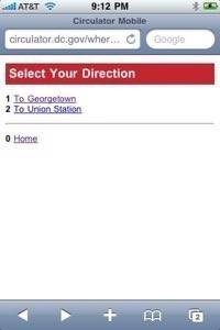
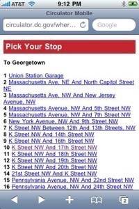
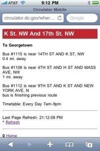
Here are a few screenshots of the dead simple app in action:
Kudos to the city for initiating Apps for Democracy and for taking the first step to modernizing and mobilizing public transportation. We can’t wait to see how private developers will expand on this application.
