Earlier today we noted that the era of location-as-platform has arrived in 2010, care of mobile services such as Foursquare and Brightkite.

In the latest in our series exploring the integration of mobile phones with Internet of Things, we look at what kinds of things you can do using your phone as a proximity sensor. Right now most of the use cases are social – for example, your phone lets you see who else is in the same location as you. But what will emerge when we add data from sensors to the mix? It becomes much more than a social platform then, because it adds millions of ‘things’ to the equation.
RWW’s Mobile Web Meets Internet of Things Series:
As Marshall Kirkpatrick wrote earlier, “where you are” has became a platform to build added value on top of – just as “who you know” has on Facebook and “what you’re doing” on Twitter. Marshall outlined some current use cases for location data – showing nearby restaurants and ratings, advertising, local news, events, Wikipedia data about local buildings.
All of that functionality can be achieved right now using geo-location data from your iPhone or Android device, data from local places (e.g. address data), metadata from businesses (e.g. pricing from local shops) and people data (e.g. user check-ins from Foursquare or Brightkite).
As impressive as that is, it’s really just the beginning. Imagine the possibilities when you add data from sensors.
DecaWave’s ScenSor uses wireless radio chips to enable “precision RTLS (Real Time Location Systems) applications.”
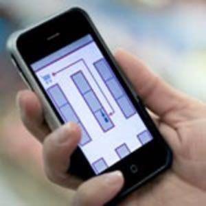
In the concept video, distance measurements are used to determine proximity and do things such as enable/disable a laptop, find a lost teddy bear, enable access in a hospital room for a doctor, identify nearby patient info and then download the correct records to the doctor, and advise of approaching friends. Other concepts shown in the video include an in-store location application guide for shoppers, proximity of tagged clothing, and information transfer capability with patient data.
The functionality shown by DecaWave is still emerging. Probably the most likely place we’ll see sensor data make an impact in the short-term is on our roads. Using your mobile phone, you could get a real-time update of traffic conditions via sensors embedded in the road. This possibility excites even those who don’t currently use the Mobile Internet. In a recent report on mobile internet usage, checking real time travel updates was listed by 33% of respondents as “the most interesting to those that don’t currently use mobile internet.”
Over the next few years, expect to see sensor-driven data add to the functionality and breadth of mobile phone location platforms. Let us know your thoughts.


