Data.gov launched in May this year to make huge data sets of information from federal agencies available in machine-readable formats. While incredibly valuable, these data sets are not particularly useful in their current format to anyone but researchers, statisticians, sociologists, developers, or others used to parsing databases searching for trends.

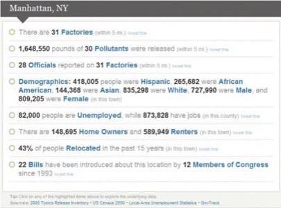
At least for geographically relevant information, ThisWeKnow provides one use case for the data sets. Users can enter the name or ZIP code of any community and get details on all kinds of factors, from violent crime to companies releasing pollutants.
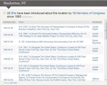
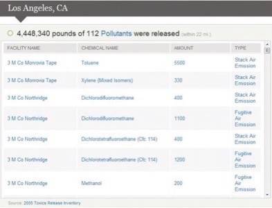
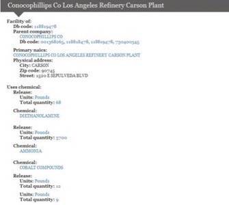
Each search for a location will generate a page of “factoids,” as ThisWeKnow calls them. Single sentences that express statistics about the community, these factoids can be clicked for deeper digging, as seen below, or can be shared on Twitter by clicking the “tweet this” links on the page.
Developed by a consortium of three different organizations (web app shop and data analysis firm GreenRiver.org, web design studio Sway Design, and semantic web database company Intellidimension), ThisWeKnow is written in Ruby on Rails. It communicates via SPARQL to an RDF database. The source code is available under an MIT license at GitHub. Users can also see the SPARQL query that generated the information on any particular page of the site.
Out of the box, ThisWeKnow presents interesting information; however, we are interested to see how the developers proceed to offer more options for sorting, comparing, and visualizing the available data.
GreenRiver.org managing director Michael Knapp addressed our desire for more granular data in an email, saying, “The presentation of these data at the town level was somewhat arbitrary – we figured it would be more recognizable to end users than block groups, etc. We needed to combine numerous data sets which present data at very different spatial aggregations, and of the 9 or 10 databases we’ve loaded, only one used coordinate data… Our vision is to have numerous facets into these data, including time (history), issues, etc., in addition to place-based ‘factoids’.”
In its first phase of development, the ThisWeKnow team has focused on a handful of spatially focused data sets from six different agencies in the Data.gov catalog. Ultimately, they hope to make the entire Data.gov catalog available to the public and give developers an API to access the data, as well.


