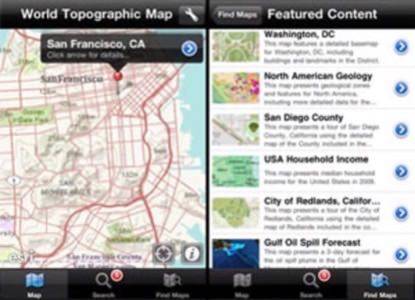
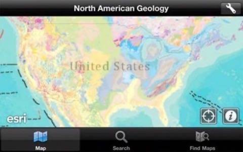
Fans of geographic information systems (GIS) can now get their mapping fix on the go, as the Environmental Systems Research Institute (ESRI) has launched an impressive mapping application for iOS devices. The California-based company specializes in providing GIS and geodatabase software applications, and holds a significant share of these markets. With the free ArcGIS app, users can now access and explore an enormous database of maps, including street maps, topographic maps, ecological maps and more.

The app is laid out very well, with three buttons along the bottom to let users quickly view the current map, search for places or features and find new maps to view. Each map also features the ability to use a few tools that let users identify locations and measure distances between two points and areas within polygons.
The app only supports maps from ArcGIS, ESRI’s suite of mapping software, including those available on ArcGIS Online and on custom server installations. Users can sign into an existing ArcGIS server to access their personal or corporate GIS data while on their iOS device. The app also categorizes public maps into groups, including featured, popular, highest-rated, recent and favorite maps.
ESRI says it is working on including the ability to collect and update GIS features and attributes, as well as perform GIS analysis through geoprocessing tasks. This means iPhone owners could use their devices to collect GIS data and upload it to services like OpenStreetMap, one of the featured map sets on the app. The next time you are walking through a park whose paths are not yet mapped, you could create a GPS trace and update the map with that data.
The company is also providing an ArcGIS API that is currently in beta, with an expected full release slated for August. “Developers and ESRI partners will use the API to create applications for both external and internal use. They can also easily build applications that work with their own published Web services,” the company said in a press release Tuesday.
While some are disappointed that the app is ArcGIS only and doesn’t support other mapping platforms like the Open Geospatial Consortium (OGC), the app is still very handy for those interested in GIS data. ESRI has such a large market share on mapping software that the lack of OGC support shouldn’t be too big of a hurdle for mapping diehards. The ArcGIS API should also be exciting, as developers now have the opportunity to create fascinating implementations of the various layers found across the ArcGIS ecosystem.