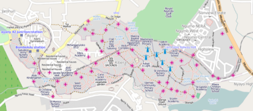
Forcing those who would rather not to recognize you is the ultimate in revolution, a revolution from non-existence to being. And that’s just what the residents of Kibera, the second largest slum in Africa, have done. Under a project they’ve called Map Kibera, they’ve publicly mapped a home the government previously depicted as wild forest (the meaning of the slum’s name) and put it online.

Using OpenStreetMap (that thing is fast becoming the phlogiston of social entrepreneurship), the 170,070 inhabitants of this slum adjacent to Kenya’s capital Nairobi have rewritten the nation’s official maps and in doing so, have made their own recognition a fait accompli.
Kenya is a place of great moment in public use of social media. Aside from being the birthplace of the Ushahidi crisis mapping tool (ReadWriteWeb coverage here), it has also passed through a particularly successful election season that gave the country a new constitution and in which social media and the mobile Web were particularly prominent.

Social media gave the people of Kibera a way of insisting they not just be serviced by their government but recognized by the country as a whole. Why is summed up in the Map Kibera wiki.
“Kibera was literally a blank spot on the map, its patterns of traffic, scarce water resources, limited medial facilities, etc. remain invisible to the outside world, and residents themselves. Without basic knowledge of the geography of Kibera it is impossible to have an informed discussion on how to improve the lives of residents of Kibera.”
Though the project was defined and funding found by Erica Hagen and Mikel Maron, a core group of about 30 Kibera locals mapped streets, public buildings and more. In the wake of a flood this last May, Reuters AlertNet notes, the Map Kibera folks were able to quickly create a map that showed which areas were under water. The dynamic, user-updated map also helps service professionals and NGOs like the Red Cross respond to needs occasioned by the area’s constant fires.
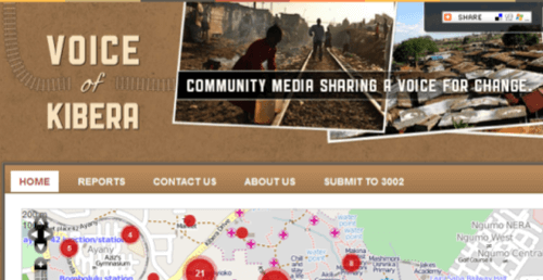
The latest step for the group is a citizen reporting site called Voice of Kibera. VoK aggregates the mapping information from Map Kibera and elsewhere, as well as streaming in SMS reports on Kibera news from locals and collects area news from other sources.

We’d love to hear of any other examples you can think of in which acts of location have helped people to become more fully present in their worlds.


