On Tuesday, OpenStreetMap significantly lowered the barrier to creating fully share-able map data. With the launch of a new editor for the open source mapping platform, its freely available mapping data will be improved upon even faster, leading to more accurate and detailed mapping information in the many apps and services that reply on it.
Starting today, anyone who wants to update OpenStreetMap can use iD Editor as one of their tool choices, alongside the existing Potlatch 2 in-browser editor. Both editors are capable tools, but the new iD Editor is much more beginner-friendly. It was always possible to edit OpenStreetMap, but iD Editor’s simplicity makes the task simple enough for just about anyone to do it – with very little training.
This is big news for certified map-heads like me, but it will important effects even for users of Google Maps and Apple Maps who have never heard of OpenStreetMap. That’s because “the free wiki world map,” as OpenStreetMap describes itself, is relied upon by a wide array of well-known apps and services.
Who’s Asking For Directions?
“OpenStreetMap’s data is used in Hipmunk for mapping hotels, and in Foursquare to map bars,” explained MapBox CEO Eric Gundersen. “It’s used in Evernote, too.” In fact, Gundersen, added, there are more than 35,000 subscribers to OpenStreetMap data through MapBox alone, including USA Today. Apple’s own iPhoto app also uses OpenStreetMap data – not Apple Map data.
The business of maps is major – according to Charlie Hale, a Google Policy analyst for Oxera, consumers have placed a $37 billion value on mapping services in the U.S. Globally, that number could be as high as $270 billion. It is little wonder then, that players like Google, Apple and Nokia (through its acquisition of Navteq) are jockeying for position, trying to be the preferred source for potential subscribers of mapping data.
No More Monkeys
OpenStreetMap’s openness gives it a big advantage in this race. Yes, Gundersen admitted, “there will be the same kind of data flaws in open data as in proprietary data, but in the open data, you can fix them.”
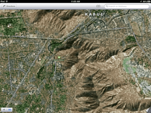
As an example, Gundersen pointed out the iOS map rendition of Kabul, Afghanistan, where a road that leads southwest out of the city’s center is prominently labeled as “Bad Monkey.”

The map’s flaw was discovered and made the rounds in the tech media way back in January of 2013. And yet, as of Tuesday, that error had still not been corrected on Apple’s iOS maps. The Chehilsoton Main Road remains unnamed thanks to someone’s poor idea of a joke.
Such errors could also crop up in OpenStreetMap, (like any vandalism you might see on open and wiki-based knowledge platforms), but it can be immediately repaired.
Fix It Yourself
In addition to more accurate maps overall, and mapping data available to everyone to use as they see fit, the ability for anyone to easily edit OpenStreetMap could also be a boon for businesses. If one of the major mapping services screws up the location for your business, for example, you have to wait for them to fix it, however long that might take. With OpenStreetMap and iD Editor, you could fix it yourself, right away.
Open source mapping was always a good idea. By making it easy for anyone to edit the maps, OpenStreetMap is making it even more useful.
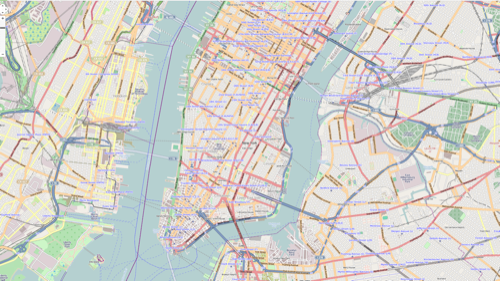
Images via OpenStreetMap, Apple.


