Imagine being able to look blocks or miles away from where you are and see how many people are hanging out at an intersection – in real time. Add a layer of precisely located Twitter messages, Foursquare check-ins, Flickr photos and other social data and what have you got? That sounds like a super power right out of a comic books to me: remote vision of where people are gathering and what they are saying.
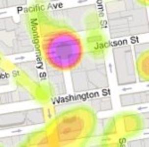
That’s what Skyhook Wireless has built as a demonstration for the forthcoming San Francisco Marathon. Skyhook is the company that provides the technology that iPhones, Motorola, and many other phones, use to discover a user’s location based on what wifi signals their phone is within reach of. Skyhook has driven all around the country and mapped out wifi, so it can augment the GPS signal your phone uses to determine your location. Now it’s publishing a real-time heatmap of where phone users are: see where people are gathering far away and what they are saying right now.
Click below to see a full size image of the Skyhook San Francisco Marathon page.
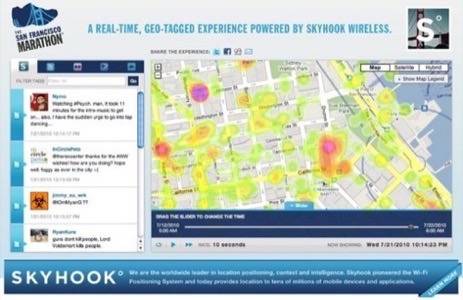
Of course this is just a proof of concept right now, and it doesn’t display terribly well yet on a mobile device, but it’s not hard to imagine seeing this scale up and out to other places and events.
Want to draw a geo-fenced area of interest on a map and get an alert when an unusual number of people starts gathering somewhere inside that area? Want to get a live satellite video feed of said gathering pushed to your iPad? Well, Sergeant Snoopy, I’m not sure whether that’s a good idea or a bad one – but it doesn’t seem outside the realm of near-term possibilities anymore. The APIs are on their way.
This is the kind of analysis and service that can be built on top of real-time anonymous aggregate information. Does this feel like a privacy violation? Is it worth the trade-off?