GeoXtract is a powerful tool that allows you to integrate your own data with Google Maps or Google Earth. Using this desktop application, you can create a personalized map with no programming experience required.

Using your own data source, which can be an Excel Spreadsheet (.xls), Access database (.mdb), or Comma-Separated Values file (.csv), geoXtract walks you through the process of creating a mashup. The program uses a wizard that helps you with the data selection, configuration, processing, and publishing of your data into either Google Maps or Google Earth.
GeoXtract doesn’t require you do do any manual processing of your data or programming and you don’t even have to modify your data set in any particular way prior to using the program.The map created by the program can be published to the geoXtract web site, to your own site, or simply saved to your computer.
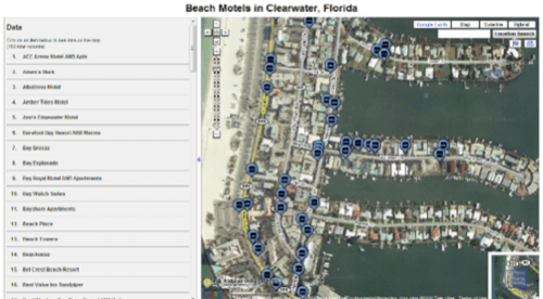
Here’s an example of a map made with geoXtract showing Clearwater, Florida beach motels:

Each map created can be saved as a “project” within the program, so if you ever need to recreate or update the map, it’s easy to do.
The application comes in four versions: Starter, Plus, Pro, and Enterprise. The Starter version is free and lets you work with .XLS and .CSV data sets. You’re also limited to 3 saved projects with no more than 100 records each. The paid versions increase these limits while also enabling the ability to work with various other file types, like .MDBs or even OLEB/ODBC in the Enterprise version.
You can download the application for yourself from here.


