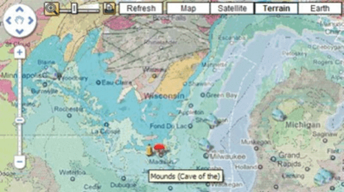
A group of cavers has used Google Maps to create GrottoCenter, a huge online atlas of spelunkable caves.

Now, whether you dig maps because they allow you to get where you’re going more efficiently or because they act as “data visualization” for the imagination, this is intriguing.
If you’re a caver, you probably already know about the GrottoCenter, but if you don’t, it offers an avenue to extend your sense of space in your world.
GrottoCenter is a wiki-like database that is maintained by volunteers and users. Over 12,000 caves are listed in the maps and the maps use a number of special symbols to succinctly provide additional layers of information.
a description of the access to the cave
a cave description
a description of rigging and ropes needs
a reference to any linked web site
some comments (by cavers) with an evaluation of aesthetics etc.
Personally, I think a map of the Nile will prove more practical than a map of caves. In fact, unless things go terribly, terribly wrong, I’m more likely to need an historical map of the Roman Empire at its height than a map of a five mile deep cavern. But looking at these self-laid plots of the underground world is almost like going from a two-dimensional world to a three-dimensional one. Even when you do not share them, it is still intriguing to look at a dynamic record of the passions of others.


