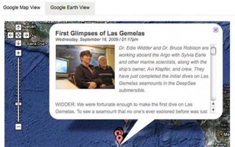
Whether you’re a lifelong fan of Jacques Cousteau or you’re intrigued by The Life Aquatic’s mythical jaguar shark, Google has a new tool for you. The company announced updating the Ocean Expeditions layer of Google Earth with blog posts and comments from recent excursions. Groups like the Census of Antarctic Marine Life and National Geographic’s Ocean Now Pristine Seas Expedition have been mapped and tagged for audience exploration.

From the decks of frigid icebreakers like that of the US Coast Guard Healy arctic expedition to Roz Savage’s solo row across the Pacific, Google Earth offers viewers a chance to get in on the seafaring action without getting seasick. In February ReadWriteWeb covered Google Earth’s new touring features and underwater ocean maps. With the product’s layers, users have always been able to add videos and still images; however, this latest effort to document ocean journeys has a number of cool uses including tracking marine biologists, sailing regattas and offshore fishing expeditions.

Google Earth 5 also offers touring with voice recording so teachers can actually walk students through a voyage’s route prior to viewing the expedition layer. To check out this tool download the KML file and open it in Google Earth. For the latest news on National Geographic’s Ocean Now Expedition to Cocos Island and the Gemelas Seamounts, you can also check out the Google blog guest post by Sylvia Earle.
Photo Credit: Arctic Ocean Exploration Cruise


