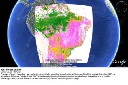
At the United Nations COP 16 conference today, Google unveiled its latest Labs project, Google Earth Engine, a new tool to give scientists, communities, and environmental activists with better access and understanding of climate change. Google Earth Engine is an online environment monitoring platform that provides a dynamic, digital model of the planet that is updated daily.

This new platform brings online for the first time an “unprecedented amount of satellite imagery and data” – the complete archive of more than 25 years of historical satellite imagery. This archive is on the terabyte scale, and few organizations have the storage or computing power to handle it. Therefore much of this information has up til now gone unused.
Google hopes that the new Earth Engine will allow people to better monitor and visualize environmental changes. This project is important, says Google, as “scientific analysis can transform these images from a mere set of pixels into useful information–such as the locations and extent of global forests, detecting how our forests are changing over time, directing resources for disaster response or water resource mapping.”

Google says it is donating 10 million CPU-hours a year over the next two years on the Google Earth Engine platform, to strengthen the capacity of developing world nations to track the state of their forests. According to Google, “for the least developed nations, Google Earth Engine will provide critical access to terabytes of data, a growing set of analytical tools and our high-performance processing capabilities. We believe Google Earth Engine will bring transparency and more certainty to global efforts to stop deforestation.”
The Google Earth Engine API is currently available to a small group of partners, but hopes to expand the program’s reach as well as its functionality.


