I want an app that automatically sends me a link to the Wikipedia entry for any historic building I travel nearby. I want to leave a note for my wife on a map, so she’ll get a text message when she bikes past the neighborhood where we first met. I want to see all the places I’ve gone in my home town and get restaurant recommendations from areas I haven’t visited in a long time.

Those kinds of things could really happen once a startup called Geoloqi launches soon. Geoloqi turns your mobile location into a platform for messaging, programmed functionality and temporary, limited sharing. The consumer service could make the dream of passively consuming ambient information about our surroundings a reality and the program’s code is intended to enable any other developer to add location services to their applications. It’s the fruit of several years of experimental location tracking and the company says it will launch publicly in the coming weeks.

Above: Geoloqi co-founder Aaron Parecki has been tracking his travels throughout Portland, Oregon by GPS and mobile phone for the last two years.
Color coding is based on the speeds he was traveling.
Geoloqi is an open source server and client program, entirely volunteer built, nearest to completion on the iPhone but usable on any phone through the very simple Instamapper GPS app. The software is free; co-founders Aaron Parecki and Amber Case envision turning it into a business by charging for API calls or facilitating opt-in location based advertising.
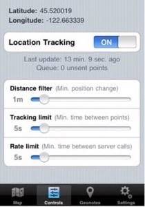
For now, though, it’s geeks hacking for the sake of the tech. Parecki is building the server and website, and Case is doing interface design, marketing and co-ordinating the volunteer developers who are donating their work because they think the project is exciting. Parecki and Case have invited limited beta testers into the program already and say they hope to submit the nearly-finished iPhone app to Apple in November.
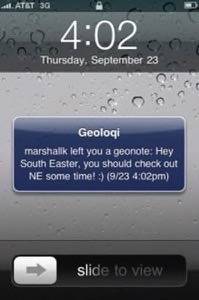
You can drop a geonote for Case via this page. Just designate a city, neighborhood, area or block, enter your message, name and email adress. The program will tell you how likely she is to receive that note, based on how often she’s traveled through that area in the last 30 days. If she enters the area designated, she’ll get your note sent by SMS and you’ll get an email letting you know it was sent.
That’s because Case has opted-in to receive public geonotes. Other users will choose only to share their location temporarily with one other person (through a live tracking map that will expire after a given period of time), to just leave themselves geonotes or to subscribe to any of a menu of geonote layers uploaded through the Geoloqi API.

Those layers will be simple data sets made up of items, with a latitude, longitude and radius. They can prompt any number of command-line style actions, you can even check-in automatically to your favorite designated locations on Foursquare or Gowalla. The default layer will be a global collection of Easter Eggs.
This isn’t at core about sharing your location, though, like other services are. This is about turning your location into programmable data, actionable information for automated processes, including but not at all limited to person-to-person messaging. Still, no matter how unfair it seems, the young company will have to deal with privacy concerns as they leverage persistent tracking. As an opt-in service, Geoloqi hopes to avoid that kind of concern.
Indoor location tracking and battery life are also issues, but the Geoloqi team says they are working on variable settings that help minimize their service’s drain on the battery.
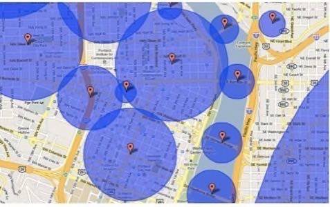
Above: Areas Case has designated where she’ll be automatically checked-in when entered.
You know what I want? I want to think of a thing, or a type of thing – like the world’s best coffee shops, fantastic vegetarian restaurants or places where news reports say that a wild baby animal has been seen. Then I want to geocode those locations, upload them to Geoloqi and subscribe to push notifications whenever I approach one of those places. And I want to subscribe to the layers of annotation that other people publish as well.
I want to be able to stand in front of a building, declare my location to an online service and find out what the person who first owned it did for a living and when the intersection I’m standing at has been in the news, ever. An ambient information service, that’s what I want.
I want to be able to track my own location and to enjoy services based on it.
My fingers are crossed that Geoloqi is going to be as useful as it sounds.
The Geoloqi API will launch on October 1st and the team is co-sponsoring an Open Government hackathon, along with Seattle based cloud messaging API provider Tropo, in Portland on October 3rd.
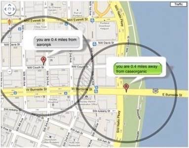
Below: Parecki (@aaronpk) and Case (@caseorganic) set up a temporary link to to share their locations with each other as they travel across town.
