Google Maps developers just launched a drawing library for the Google Maps API, so that developers who build on Google Maps can add simple tools for users to draw markers, lines and shapes on to maps. Shapes can also be made editable, even once they’ve been placed on the map.
Applications can use drawings for selecting regions of the map to search or highlight, as well as for annotations. This simple interface offers a surprising range of features for developers building applications upon Google Maps.
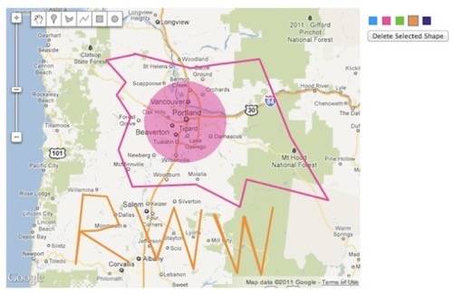
There’s a working demo embedded on the Google Geo Developers Blog. Try it out; it’s easy to use, but it’s surprisingly flexible. While it’s easy to make stupid doodles like I did, the interface is quite precise, so this new library can definitely be used carefully to mark up or highlight maps. Developers could build this into their applications for fun or work purposes.
What uses could you see for the new Google Maps drawing library?