At Microsoft’s San Francisco campus this morning, a room full of tech journalists and entrepreneurs were treated to their first glimpse of Bing Maps Beta. When Microsoft first spoke about it’s efforts towards geospatial projects, many were skeptical; nevertheless, it looks like the search giant has managed to deliver.

Bing Maps is built on Silverlight and offers 3 different viewing dimensions. The most interesting, the 3D Streetside (street view), offers seamless stitched imagery for 100 major cities with more planned in the coming months. As for bird’s eye view, the mapping service has data on about 95% of the US. And finally, the aerial perspective is internationally available.
Photosynths
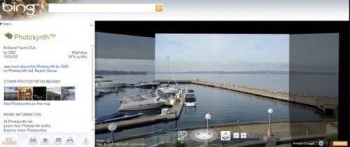
Microsoft has already begun incorporating Photosynths or user generated data onto its maps. These Photosynths can be viewed from the Streetside perspective and offer users a chance to drill down for more information on particular points of interest. There are already Synths mapped within New York’s Metropolitan Museum of Art.

App Gallery
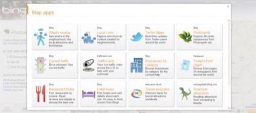
Microsoft has already seeded the beginnings of its map app gallery. Some of the maps featured by the company include:
1. Twitter: Users can get real-time event updates and tweets from the originating location.
2. Local Lens: Microsoft indexes local blogs to form hyperlocal routes and event feeds. Says the company, “It’s an entirely new way to consume local crowdsourced information – something 72% of customers do routinely on the web.”
3. What’s Nearby: If you already know where your meeting is, Bing Maps offers users a chance to search nearby restaurants and services. The company combines public data from sites like
and
and allows users to gain rich data for their location-based searches.

To check out the service for yourself visit bing.com/maps/explore.


