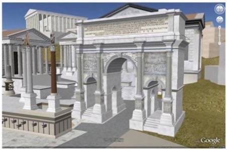
For a lot of students, the history of ancient Rome is not exactly a gripping subject. Google, together with the University of Virginia’s Institute for Advanced Technology in the Humanities (IATH) is trying to change this. Starting today, Google Earth will feature a new layer, ‘Ancient Rome 3D,’ which is based on the IATH’s ‘Rome Reborn’ model and which displays a 3D model of the city as it existed in 320 AD.

Overall, the Rome Reborn project recreated detailed models of over 6,700 buildings and monuments in the city, including some, like the Coliseum, which also feature highly detailed interiors. The new layer also adds a lot of new placemarks with historical information geared towards students.

As the Google Earth team points out, this is the first time that Google has included an ancient city in Google Earth. Of course, there have been a good number of other projects that have reconstructed ancient cities in 3D, but very few of these are accessible over the web.
Google also announced a curriculum competition in conjunction with the release of this new layer. Six K-12 educators who create the most interesting curricula based around the Ancient Rome 3D layer will receive new Mac laptops, classroom projectors, and a digital camera.
Note: this layer was supposed to be widely available by now, but so far, it does not seem to be appear in Google Earth yet.
Bonus: if you want to see what the future of 3D maps might look like, have a look at this model of Oslo.


