Parts of Canada finally have their own Street View maps, but surprisingly, they didn’t come from Google. Instead, the maps were created in a joint effort between British Columbia-based Canpages.ca and San Francisco-based MapJack, two companies that have teamed up to provide the service which Google has yet to bring to Canada. These new Street View maps also have features that the search engine giant doesn’t offer, including a fullscreen mode and views of pedestrian pathways where cars can’t travel.

CanPages Introduces Street View Maps
Canpages.ca, the Canadian business directory listing service similar to the Yellow Pages in the U.S., is home to the new mapping service where it’s accessed by performing a search on their homepage. After your search results appear, they are accompanied by a traditional map of the business location. At the top of the map, you’ll see an option to select “Street View” from the menu bar when it’s available. You can also click on any of the blue highlighted streets to delve directly into Street View at that particular spot. As with Google’s Street View, you can click on arrows to move forward and backward and there’s even a small cartoon figure that appears on the map for reference.
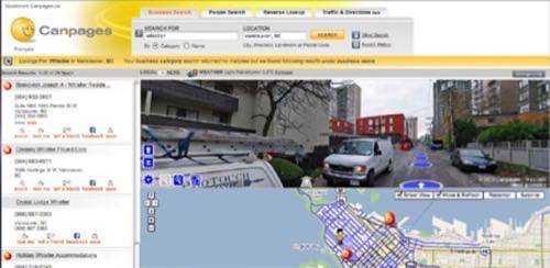
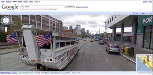
Although the CanPages’ Street View maps offer many similarities to Google’s, what’s most notable about this launch are the many differences between the two services. For example, all of the CanPages maps have been created using high resolution photography. Google, on the other hand, has only used high-res imagery in a select handful of international cities including San Francisco, Paris, and Seattle.
CanPages’s maps also offer a fullscreen view which you can use to fully immerse yourself into the city scene. However, don’t try to tilt the camera up to the sky – that’s one feature the CanPages maps don’t have – they’re limited when it comes to panning vertically.
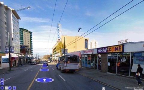
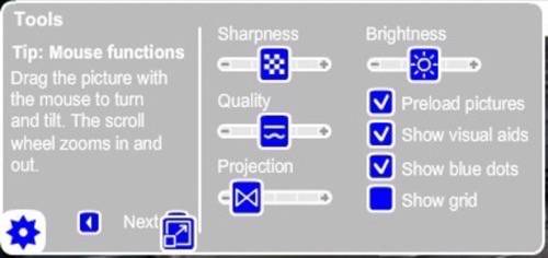
Another feature of the new Street View maps is a configuration menu which allows you to customize settings like image sharpness, brightness, quality, and projection or the curved effect. You can also choose to turn on or off additional visual aids, the blue navigation dots, or the grid.
Perhaps the nicest feature, though, is the pedestrian maps. Captured by a team of photographers who traveled on foot with shoulder-mounted cameras, the CanPages maps let you explore parts of cities where cars can’t go. For now, this allows you to travel down pedestrian walkways, but the company hopes to use their unique camera set up in the future to film hotel lobbies, retail stores, shopping malls, and parks.
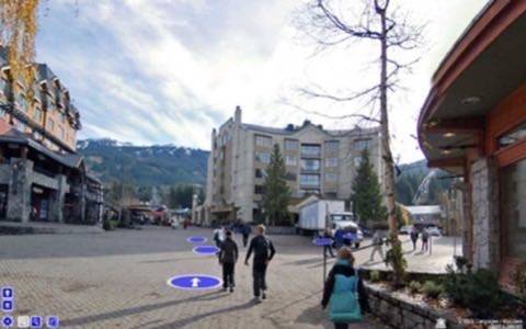
CanPages also made privacy a priority from the start. When Google launched their service, faces and license plates were plainly visible. Only recently have they responded to people’s concerns and began to blur these images. On the CanPages maps, however, not only are these items blurred, there’s also a link at the bottom-right corner of the map that lets anyone submit concerns about that particular image.
A Better Street View
Considering that Google’s Street View technology has still not made its way to Canada, the CanPages maps provide a good alternative – actually, given the features offered, we could even say they provide a better one. For now, CanPages Street View maps encompass the cities of Vancouver, Whistler, and Squamish (all in British Columbia). The company plans to expand to Toronto and Montreal next, followed then by as much of Canada as possible.
Image credits: krisabel.ctv.ca


