Google Street View has made a few headlines at RWW lately – once for getting itself into hot water in Europe and once, notably, for bringing Street View’s photo-tour features into retail outlets.

Now, we’ve learned that Street View will also begin to feature user-submitted photographs. According to a recent Google Lat Long blog post, “We began integrating user photos into Street View last year. User photos allow you to view locations from entirely new perspectives, whether through the eyes of a talented photographer with a knack for capturing architectural detail, or simply taken from locations we couldn’t get to… We’re making it easier to navigate through these images in a way that should feel similar to how you’re used to exploring within Street View.”
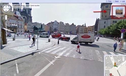
Users can submit pictures from Picasa, Panoramio and Flickr that show different views, times of day or pedestrian-only areas. Here’s an example of what the interface looks like; the square in the top right corner indicates there are user-submitted images for that area.

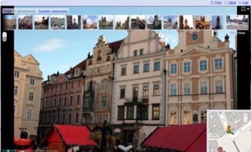
And here is the photo navigation interface. Users can also navigate through photos using new click-and-drag controls to see images from nearby areas, or different angles or crops of the same area.

Some have speculated that Google has chosen to highlight and integrate this feature because of competition with Bing. The Next Web recently called Microsoft’s Photosynth, a similar product launched in 2008 and integrated into Bing Maps, “the killer app of the Bing suite” that differentiates Bing from Google in a positive way.
“The feature,” wrote Jacob Friedman , “displays collections of photos stitched together into a panorama[…] The results, to put it bluntly, can be spectacular.”
While Google’s offering may not have the 3D-esque quality of Photosynth, allowing for more creative images and photos from a larger geographical area to be shared in Street View is a smart move for the company. Let us know what you think in the comments.


