With a smartphone and the right app, you can find any spot on Earth. But the best navigation apps do a lot more. Look out for that speed trap.

Here are six mobile navigation tools. To make the list, an app needs to be different than your standard, run-of-the-mill route finder. You won’t see Nokia or Google Maps. Or apps from navigation leaders like Garmin, TomTom or Telenav. These are seven true alternatives. Each one offers something special to help you get wherever you need to go in record time.
Waze
(Free: iPhone/iPad, Android)
When we first wrote about Waze (for Android) in our Apps of the Month for December 2011, we wondered whether the app was useful, never mind safe. Interacting with your phone while driving is frowned upon these days. Waze’s safety may be debatable, but its GPS features and ability to passively aggregate traffic data while you’re driving may be useful. It’s a social driving app that alerts you to traffic incidents, congestion and other roadblocks so you can “outsmart traffic and save on gas.” Really, the last thing you need is to be scanning Twitter in traffic. It’s especially worthwhile if you live in a city where the afternoon commute tends to be a nightmare (looking at you, Washington, D.C.). Just type in an address, and Waze passively sends traffic data to its servers and lets you know where the trouble spots are.
Where2Boss
(Free: iPhone)
I went to Fiji as a teenager. On the way home, I had a long layover at LAX before flying back to Logan Airport in Boston. A couple of people I had met in Fiji were also stuck at the airport, so we decided to take a cab to Manhattan Beach, where Baywatch was filmed. They ended up leaving earlier while I sat on the beach looking for Pamela Anderson in a red swimsuit. When it was time to go, I hopped in a cab back to LAX – and was taken for a ride. The taxi ride to the beach cost about $25. On the way back, the driver took a very long route, along with the last $50 in my pocket. This was the mid-1990s, and there was no smartphone I could use to track the route and stop the driver from fleecing me like the dumb teenager I was.
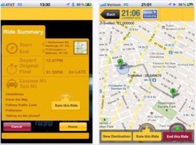
I sure could have used Where2Boss. It compares the route your taxi driver is taking with the one it thinks you should be taking. It also has a rate-your-driver function, forums to offer comments or complaints about drivers, and gamification badges that tell you whether you’re beating public transit. Smartphones: keeping taxi drivers honest since 2007.

CoPilot GPS
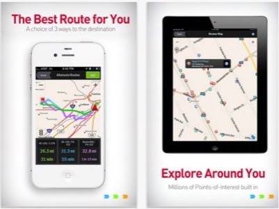
I had a problem while traveling in London last October. First, I had no idea where I was. Second, I didn’t have access to cellular data that would have enabled my Android or iPad to figure out where I was (no way was I going to spend on international roaming). I managed to duck into a Starbucks and grab some Wi-Fi for a couple minutes to get my bearings, but I got lost several times anyway. CoPilot GPS would have made it a cakewalk. Available for iOS and Android, CoPilot provides free navigation tools, including maps and directions, without a data connection. It also provides alternate routes and points of interest along your way. I was able to stumble toward Piccadilly Circus and then Westminster Abbey by blindly walking south, but that would not have been necessary if I had an offline maps and navigation service.

Trapster
Many U.S. states have outlawed radar detectors that enable drivers to avoid police officers when they’re driving too fast. Police don’t appreciate citizens skirting the law, and a radar detector really has no other purpose. But that doesn’t mean you can’t use an app to avoid speed traps. Trapster alerts you to speed traps, red light cameras, accidents and traffic. The newest version is packed with features, including a “blue line” navigation on the map to show you where previous Trapster users have driven recently without close encounters of the ticket kind.
HopStop
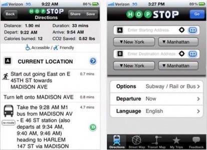
HopStop is one of the more useful and intuitive navigation apps for city dwellers. It delivers not only walking directions, but precise information on public transit options. Very helpful if you’re in a new city or an unfamiliar part of town. Enter your address and where you want to go, and HopStop will give you all the route information you need.

Extra Mile
($0.99: iPhone)
Extra Mile is a voice navigation app that runs in the background while you drive. It automatically records distance traveled, fuel expenses, trip duration and driving patterns. It also taps into traffic cameras so you can see what you are getting into before you get into it. It offers a dashboard for easy in-app navigation and generates reports of your driving history.


