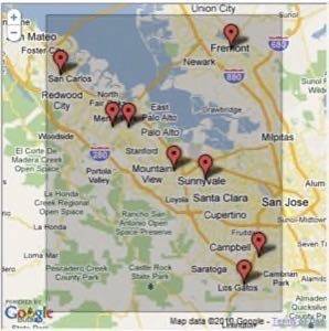
Today on its Geo Developers Blog, Google announced support for spatial queries in Fusion Tables. Google announced last week that the Google Maps APIMaps DATA API is being deprecated and that Fusion Tables is the replacement. In that announcement, it was mentioned that spatial queries were added to Fusion Tables. It’s not clear whether there were new queries added today or if this announcement is meant to reiterate the transition to Fusion Tables. The documentation for spatial queries in Fusion Tables can be found here.


According to the announcement, spatial queries will enable developers to:
- Find all features that are located within (or overlap with) a given distance from a location
- Find all features that are located within (or overlap with) a given bounding box,
- Find a given number of features closest to a location.
In the example given, a developer could put a list of locations of a pizza chain in a table and then use a query to map all the locations within a given distance or within a specific area.
Fusion Tables is a cloud data management service. The idea is to help developers on opposite sides of a firewall collaborate on large datasets. “Fusion Tables is not a traditional database system focusing on complicated SQL queries and transaction processing,” the original announcement says. “Instead, the focus is on fusing data management and collaboration: merging multiple data sources, discussion of the data, querying, visualization, and Web publishing.”


