Humans’ relationship with “place” is a lot richer and more complex than simply “checking in” for mayorships, badges, or free Gap jeans. All the buzz about location-based apps fails to address why we deem some places sacred, why we put up historical markers, and why we seek to preserve certain historical sites. Sure, the growth of location-based social networks points to the importance of “who goes there.” But our curiosity about “who was there” extends back farther in time, I’d contend, than simply which people Facebook or Foursquare may list as recent visitors.

And as our scrapbooks and our archives show, the photographs we take do not serve simply to mark who we are with, but where we have been. Photographs serve to capture time and place, and they foster personal memories and provide historical records of how places have changed.
What Was Here Before Us?
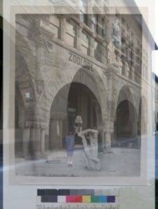
LookBackMaps offers a way to link the history and the present of a particular location. By geo-coding historical photographs, the project allows us to easily see what a place used to be like when we visit it today.
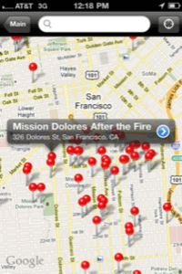
LookBackMaps offers both web-based maps, as well as an iPhone app. And the latter boasts an augmented reality feature that overlays a historical photo on top of the view from your camera, giving you a glimpse of city streets and buildings as they were in the past. The app will guide you to the site of a particular photo, so through your camera you can see “then” and “now” simultaneously.
Even better, perhaps, it also allows you to snap your own photos with this view, so you can, in effect, place yourself in a photo of turn-of-the-century San Francisco or in a photo of a Civil War regiment.
LookBackMaps, Linked Data and the Civil War
As a San Francisco resident, LookBackMaps founder Jon Voss has understandably done a lot of work to organize photos from that city. But LookBackMaps’s latest project has a much larger scope, in terms of regions and history and in terms of cultural preservation and linked data.
To mark the 150th anniversary of the U.S. Civil War in 2011, LookBackMaps has launched the Civil War Data 150 Project. In partnership with the Archives of Michigan, the Internet Archive, Freebase, and the University of Richmond Digital Scholarship Lab, the project aims to share and connect Civil War data across local, state, and federal institutions.
By utilizing Linked Open Data, the project will help connect the data in such a way that it can be found, no matter the collection, the archives, or the library in which it’s housed. And the project also provides an opportunity for citizen-archivists, of sorts, to go through and help identify and tag photos – be they of battlefields, regiments, or soldiers.
If part of the purpose of LookBackMaps is to help find the connections between places and photographs, the Civil War Data 150 Project has a far grander goal about location, history, and our cultural heritage – one that demonstrates a failure of imagination in those that think that the “location” battle has been won by any Internet company.
Photo credits: California Historical Society


