Google Earth has always had an incredible “wow” factor. But the newly-released Google Earth 6, in Google’s own words, takes “realism in the virtual globe to the next level.” This version adds two new features, an integrated Street View experience and 3D trees, and also makes it easier to browse historical imagery associated with a specific location.

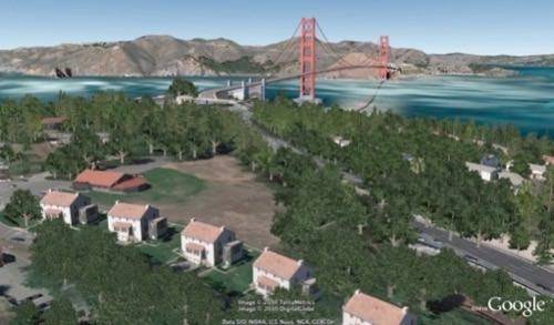
Google Earth provides a wealth of computer-generated building models, but Google notes that trees have been “rather hard to come by.” In the service of boosting the realism substantially of the 3D world substantially, today’s Google Earth release includes models for dozens of species of trees. Google says it’s already “planted” over 80 million trees in Google Earth.
Street View isn’t a new feature for Google Earth. It’s been available since 2008. But the experience is now fully integrated, so you can zoom from the outer space view of Earth smoothly and seamlessly to your doorstep. Simply drag Pegman, the Street View mascot, onto any place where you see a blue highlighted road, an indication that Street View is available. And from there you can use the navigation controls to move around.
Like Street View, the availability of historical imagery via Google Earth isn’t entirely new. But this release makes these images far easier to find. When you fly to an area where images are available, the date of the oldest imagery will appear in the status bar. Clicking on it will transport you to that view, and you can browse through other images for that location.


