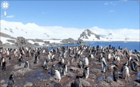
Just over three years ago, Google launched Google Street View with imagery for just five U.S. cities. Today, the company that’s categorically trying to digitize everything about our world – from language to location to all the world’s written knowledge – announced that it has brought Google Street View to all seven continents.

If you’re looking for some Antarctic real estate or some beachfront property on the Emerald Isle, Google Street View can now give you a glimpse of what you’re getting into.
According to a blog post on the Google Lat Long Blog, the addition of Street View Imagery for Brazil, Ireland and Antarctica completes the continental list, bringing at least partial imagery for all seven continents to the service.
We often consider Street View to be the last zoom layer on the map, and a way to show you what a place looks like as if you were there in person–whether you’re checking out a coffee shop across town or planning a vacation across the globe.
Much as Google Earth allows you to virtually explore the planet – from mountain tops to the ocean depths – Google Street View offers a ground-level peek at places in the world you might never otherwise see.

The service hasn’t been without controversy, as many people (and countries) have petitioned to block the service or prevent it from showing identifying information.
We doubt, however, that the penguins will have a problem.


