
Although trowels and brushes are still de rigueur for archaeologists, electronic and web-based tools are fast losing their exception-to-the-rule status. The latest patch of ground to get the electronic treatment is the seminal World War I battleground of Gallipoli.
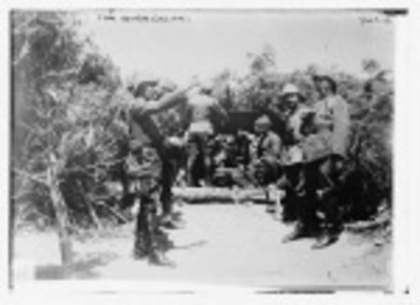
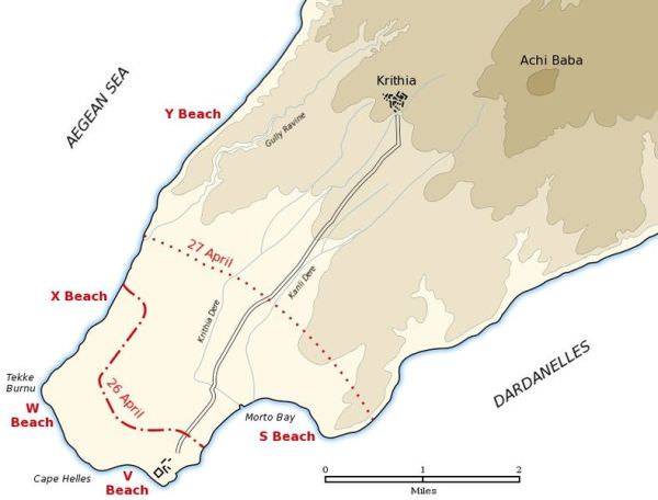
The Turkish European peninsula of Gallipoli in the Dardanelles was a lynchpin in the fight against Germany’s ally, the Ottoman Empire. During the eight-month campaign, which began 100 years ago Monday, over 70,000 allies and 20,000 Turks lost their lives. Now a group of archaeologists in Turkey are uniting GPS and WWI-era maps to create a definitive record of trenches, redoubts, battle lines, tunnels, roads and paths and burial grounds.
The high rate of allied casualties, caused by repeated hesitations and screw-ups on the part of the commanders are remembered by the countries who participated. Celebrated as the memorial Anzac Day in Australia and New Zealand, it is also a day of pride for Turks, who were wildly under-estimated and dismissed by the allies as the “sick man of Europe.”
The survey, the only one since a 1919 post-mortem, is being led by University of Melbourne Professor of Archaeology, Antonio Sagona. The first survey took place in late 2010 and the process is ongoing. His group consists of Australian, New Zealand and Turkish archaeologists and historians. The undertaking is funded in part by the Australian Department of Veterans’ Affairs, the New Zealand Department for Culture and Heritage and Turkish authorities, according to Opti-Cal.
Australia’s News4us quotes that country’s Minister for Veterans’ Affairs, Warren Snowdon on the project’s import.
“”Despite the historical importance of the Gallipoli battlefield, our knowledge of this area to date has been based on maps and written accounts. This area has never been studied in detail through modern archaeological survey methods. “This is the first time that we have had the opportunity to corroborate and further explore the events surrounding the Gallipoli campaign which proved such a defining moment in the formation of our nation’s identity.”
The project is using Differential Global Positioning System technology with a hand-held GPS receiver with “an external high-accuracy antenna” in the field and a fixed receiver at the project base.
Gallipoli photos from Wikipedia Commons | other sources: Gadling